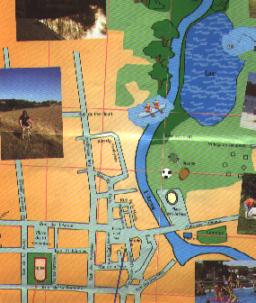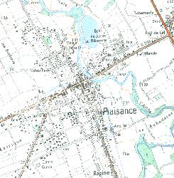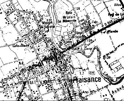
Plaisance es una " bastide" con muchas calles con ángulos rectos y dos plazas cuadradas, la Plaza dela Iglesia y la Plaza del Ayuntamiento.El rio Arros atraviesa Plaisance.En el plano de abajo se puede ver el puente y a la izquierda, el óvalo de las arenas (=La Plaza ,no de Toros pero de Vacas) y también la mancha azul del lago.Entre los dos, el estadio y las canchas de tenis y el centro de vacaciones donde estan los bungalows.
La Piscina y el camping son representados por este punto azul y esta mancha verde a la izquierda abajo.Plaisance is a "bastide",(village built in the Middle Ages) ,therefore many streets are right-angled with two typical squares with arcades, the Church Square and the Town hall Square which are named after the two last world wars' armistice days. The river Arros flows across Plaisance. On the plan you can see the bridge and on on its left, the oval of the Arenas, then the blue spot of the lake. Between the arenas and the lake, there is the rugby field, the tennis courts and the leisure area where you can rent bungalows.
The swimming-pool and the campsite are represented by this small blue point and this green spot in the bottom right-hand corner.